Natural Resource Management
Natural Resource Management
Mahiti Trust addresses the Bhal region’s acute ecological challenges—such as saline soils, erratic rainfall, and frequent droughts—by implementing innovative, community-driven natural resource management (NRM) strategies. Our work focuses on:
Restoring degraded
landscapes
through soil health improvement and eco-regenerative
practices
Conserving water resources
via rainwater harvesting, farm ponds, and decentralized water
governance
Promoting climate-resilient,
sustainable agriculture
grounded in local knowledge and practices
Strengthening community-based
organizations
to lead and sustain environmental stewardship
Through these integrated efforts, we have reached over 300,000 people—building both ecological resilience and sustainable livelihoods in one of Gujarat’s most fragile regions.
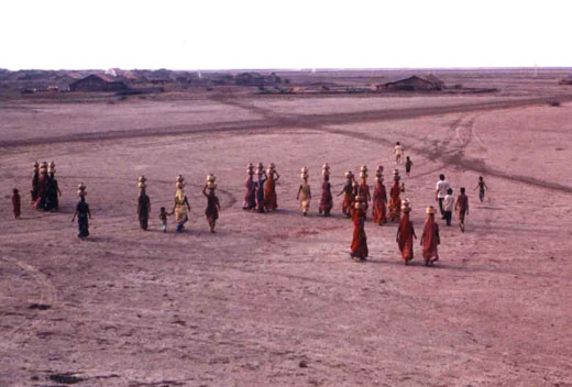
Securing Safe Drinking Water Through Community-Driven Solutions
Mahiti Trust tackles the critical challenge of water scarcity in Gujarat’s saline-affected Bhal region through innovative, community-led water management systems. We design and implement decentralized, sustainable solutions that ensure year-round access to safe drinking water—especially in underserved and drought-prone villages.
Our key interventions include:
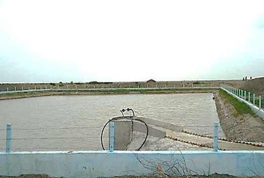
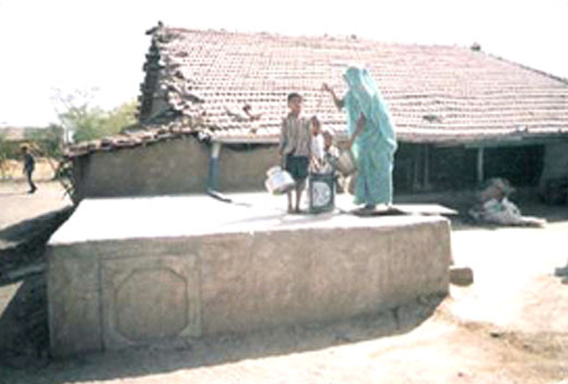
Construction of 8,550+ rooftop rainwater harvesting systems and 21+
plastic-lined
ponds, collectively storing over 8.86 million litres of potable water annually
Establishment of village-level drinking water systems in 90+
villages under
government-supported programs like Swajal Dhara and Coastal Area Development (Phases
I & II)
Infrastructure development
including pipelines, sump and overhead tanks, pumping systems, and groundwater recharge measures for both human and livestock needs
Promotion of rooftop rainwater harvesting with underground storage tanks, providing localized and reliable drinking water even during supply disruptions
By strengthening local ownership and building resilient water infrastructure, we reduce dependency on unreliable systems, improve public health, and ease the burden on women and children. These initiatives are not only about access to water—they are about restoring dignity, ensuring equity, and enabling sustainable rural development.
Reviving Land, Restoring Hope: Watershed Management Approach
Mahiti Trust leads transformative efforts in sustainable water conservation and ecological restoration across the climate-vulnerable Bhal region of Gujarat. In response to challenges such as saline soils, erratic rainfall, and sea water intrusion, we implement holistic, community-driven solutions that regenerate degraded landscapes, conserve water, and strengthen rural livelihoods.
Revive Farmland:
Reclaimed 18,000+ hectares of degraded land into
productive farmland through the Integrated Watershed Development
Program and allied initiatives across Bhavnagar, Botad, and Ahmedabad
districts.
Enhance Water
Infrastructure:
Built 13 check dams, 372 farm ponds, 25
waste
weirs, and salinity protection bunds and farm protection
bunding—ensuring improved
irrigation, groundwater recharge, and flood resilience.
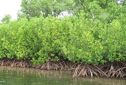
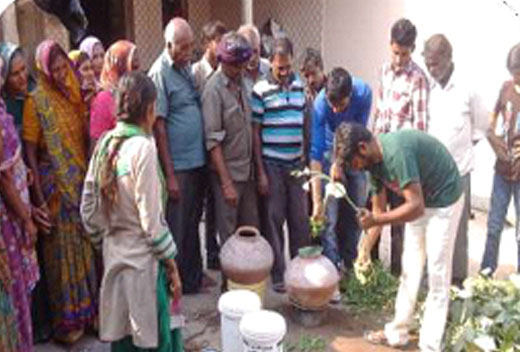
Restore Coastal
Ecosystems
In partnership with the Government of Gujarat, restored
500 hectares of coastal land through mangrove
plantations, creating natural barriers
against salinity and supporting biodiversity.
Promote Local
Governance:
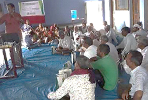
Formed 90 Village Water & Sanitation
Committees,
supported participatory planning, training, and awareness programs to ensure
community ownership and long-term sustainability.
At Mahiti Trust, we view water and land not just as natural resources, but as the foundation for life, dignity, and resilience. Our work is rooted in the belief that empowered communities and healthy ecosystems go hand in hand. By investing in ecological regeneration and local leadership, we aim to build a more just, equitable, and sustainable future for all.
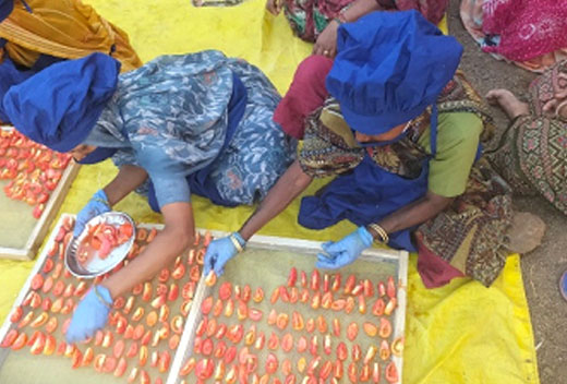
Transforming Agriculture for Sustainable Livelihoods
Mahiti Trust is leading the shift towards organic, climate-resilient agriculture across Gujarat’s Bhal region. Since 2015, we’ve been working with smallholder farmers to reduce dependence on chemicals, restore soil health, and build secure, sustainable livelihoods—especially in drought-prone and saline-affected areas.
Promote Organic Farming:
Enabled 5,000+ farmers to adopt organic cotton cultivation over 15,000+ hectares, using natural inputs like Jivamrut, Dashparni Ark, and compost.
Facilitate Government
Support:
Helped farmers access over ₹17.5 million in organic input incentives through
Gujarat’s I-Khedut portal under the state’s Organic Farming Policy.
Provide Certification & Compliance:
Guided farmers through organic certification processes aligned with APEDA, NPOP (India), and NOP (USA) standards.
Empowering Women in Agriculture:
Women are at the heart of our agricultural efforts. In collaboration with WGWLO, we lead campaigns on land rights and land ownership, seed sovereignty, and indigenous knowledge, reaching over 2,500 women farmers. Notably, 548+ women have successfully added their names to ancestral land records, strengthening their ownership and agency in agriculture.
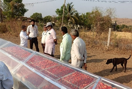
Strengthening Farmer Producer Organizations (FPOs):
As a NABARD-recognized Producer Organization Promoting Institution (POPI), we’ve supported the formation of 14 FPOs, connecting 4,500+ farmers to better markets, inputs, and services. These farmer-owned collectives drive value chain development and Agri-enterprise growth.
Our 360° Agri-Livelihoods Approach:
Farmer Collectivization
for solidarity, finance, and market access
Agri-Enterprise
Development
to boost farmer incomes by 20–30%
Climate-Resilient
Practices
using natural inputs and crop diversification
Soil & Ecosystem
Restoration
for long-term sustainability
Women’s Leadership in agriculture and decision-making